This electronic supplement contains the detailed structure-from-motion image-based modeling (IBM) workflow for paleoseismic trench photomosaics produced rapidly in the field, a 3D trench model, an example photomosaic log, a table of the error analysis data, and a Python script to export photomosaics from Agisoft PhotoScan Professional.
The workflow is designed to be a stand-alone document that researchers can take to the field for easy reference. It contains three sections: Field Workflow, Agisoft PhotoScan Professional Workflow, and Geographic Information System (GIS) Workflow.
Download/View: Image Based Modeling Workflow for Paleoseismic Trench Photomosaics [PDF; ~931 KB].
Download: Figure S1 [Zipped PDF; ~57.6 MB]. A 3D, interactive model of the Alpine trench, Wasatch fault zone, Utah. Download and unzip the PDF and use Adobe Reader or Adobe Acrobat to view, rotate, and manipulate a downsampled model of the Alpine trench. The model was created from merging the south wall and north wall projects. White areas on the trench floor are regions that were not fully reconstructed from the photoset. Use scroll or the left mouse button to zoom in and out, right mouse button to rotate, and the right and left mouse button together to move the model. (The PDF will not render properly in a web browser window.)
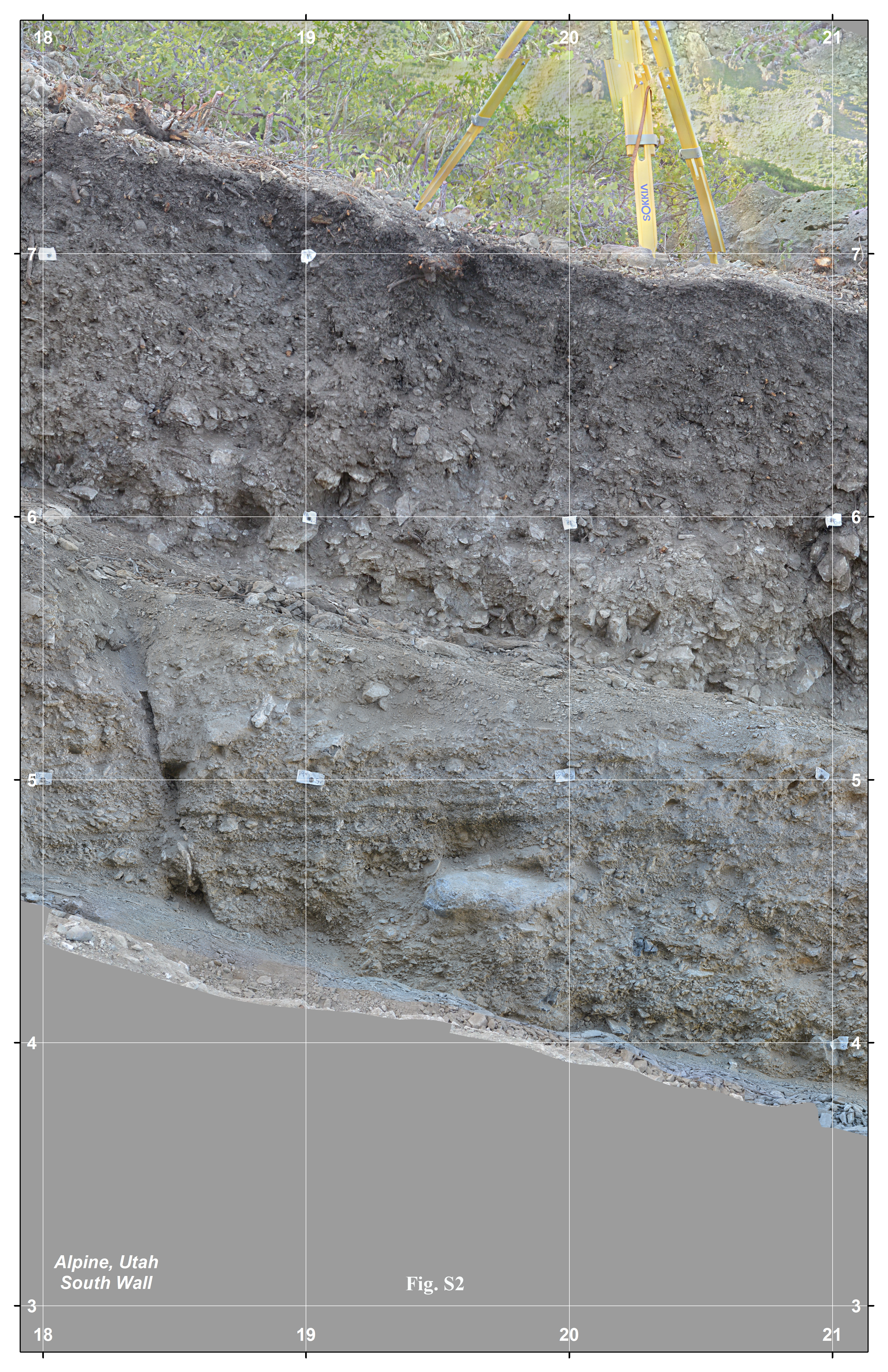
Figure S2. An example trench photomosaic for logging. Meters 18–21 of the Alpine trench south wall, which we printed at 11 in. × 17 in. for field mapping. We deleted areas of the model mesh outside of the trench exposure, which causes the ghosting of the tripod legs visible in the image.
View: Figure S2 [PNG; ~24 MB] or Download: Figure S2 [Zipped PNG; ~23.8 MB].
Table S1. Error analysis data.
Download: Python script [Plain Text; 5KB]. Script provided by Agisoft for exporting photomosaics from Agisoft PhotoScan Professional v.1.1 in a vertical plane (see Data and Resources).
Processing of the 3D model presented in the workflow was completed in Agisoft PhotoScan Professional Edition v.1.1 (PhotoScan). The Python script provided to export photomosaics must be run through PhotoScan. GIS v.10.2 was used to manipulate and print photomosaics exported from PhotoScan. The PDF of the 3D trench model can be viewed and rotated using Adobe Reader or Adobe Acrobat.
James, M. R., and S. Robson (2014.) Mitigating systematic error in topographic models derived from UAV and ground-based image networks, Earth Surf. Process. Landf. 39, 1413–1420, doi: 10.1002/esp.3609.
Any use of trade, product, or firm names is for descriptive purposes only and does not imply endorsement by the U.S. Government.
[ Back ]