This electronic supplement contains figures illustrating the distribution of seismic stations and the location results of the Korean Earthquake Early Warning System (KEEWS).
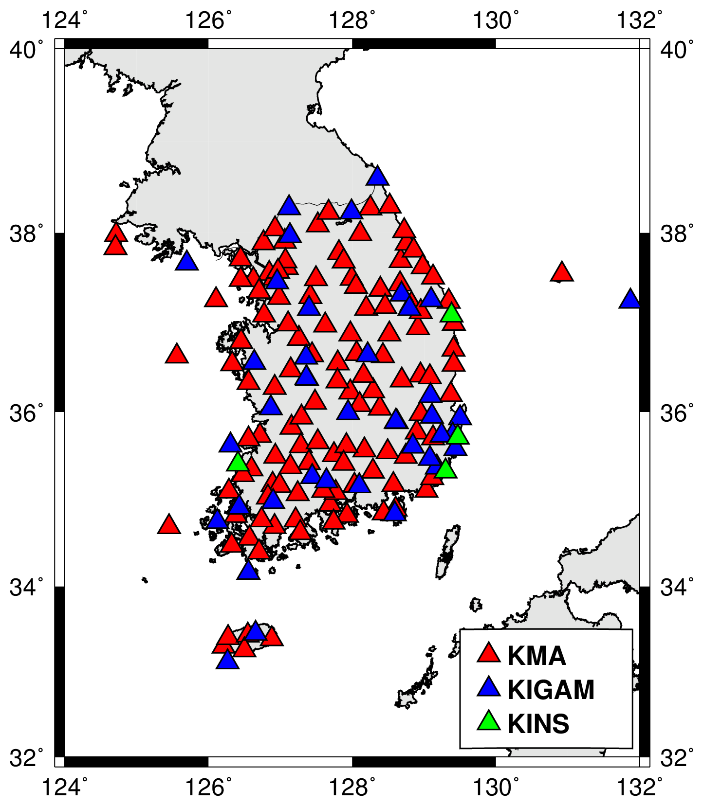
Figure S1. Stations that send seismic data to the KEEWS. The number of stations are given in Table 1 in the main article.
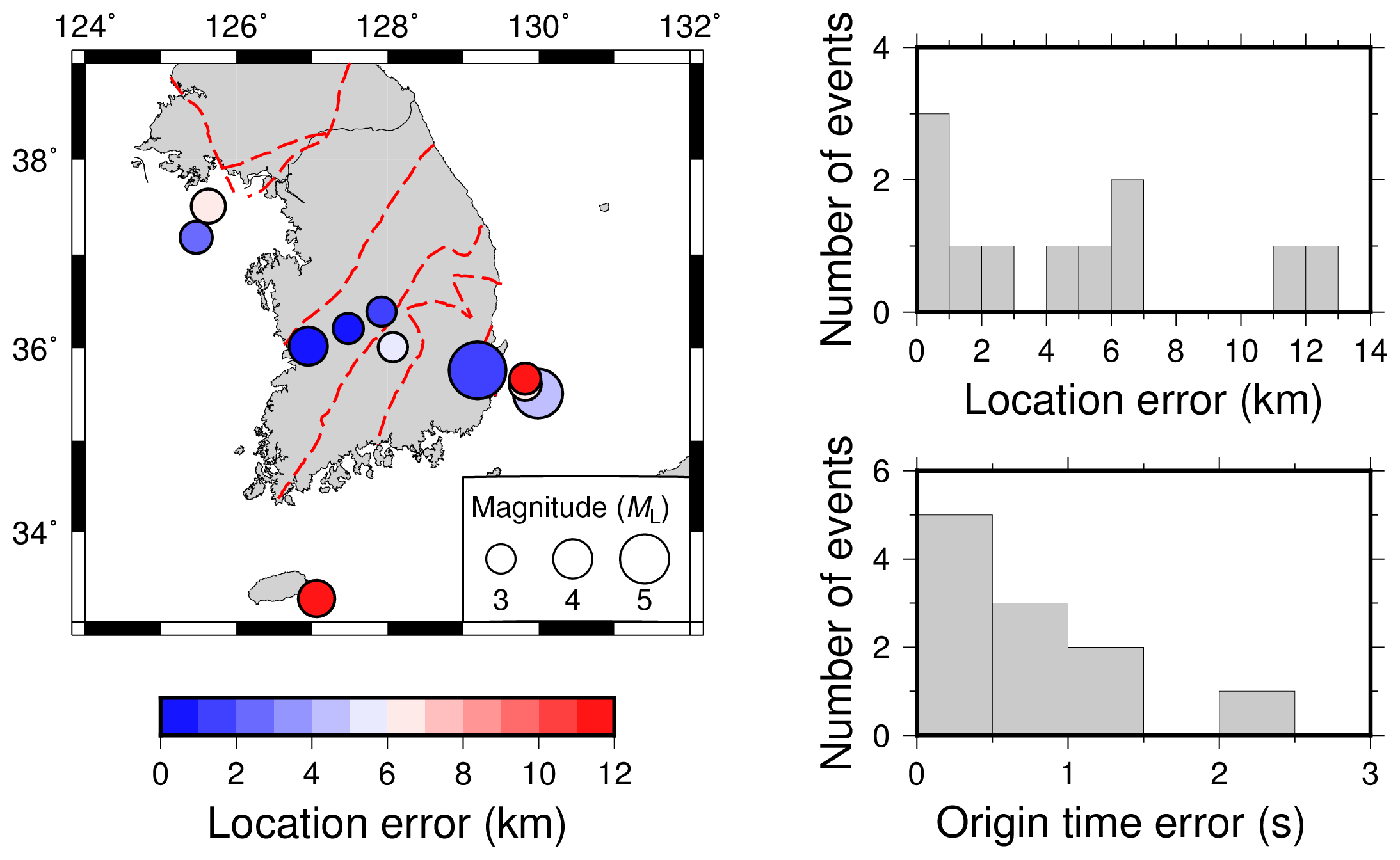
Figure S2. Event location map and error histograms of the events in Table 2 in the main article. Red dashed lines on the map indicate geological boundaries.
[ Back ]