(g) Locs. 272-343 (16 photos): Khun Bandi to Maslipain (Appendix Map g)
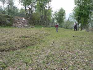 |
Photo g-01 (Loc. 277) Slight southwest-facing flexure in the village of Kun Bandi. Looking southeast. Photo taken by H. Tsutsumi, on March 12, 2006. |
 |
Photo g-02 (Loc. 287) Small southwest-facing monoclinal scarp southeast of Kun Bandi. Looking east. Photo taken by H. Tsutsumi, on March 12, 2006. |
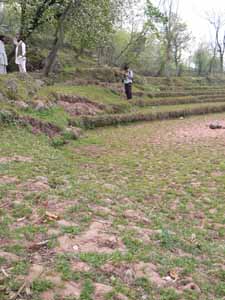 |
Photo g-03 (Loc. 296) Southwest-facing monoclinal scarp along the base of a distinctive preexisting fault scarp on the M surface. Looking southeast. Photo taken by H. Tsutsumi, on March 12, 2006. |
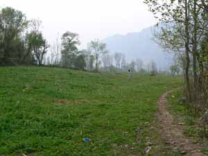 |
Photo g-04 (Loc. 302) Broad southwest-facing warp north of Phulhotar da Katha. Looking south. Photo taken by H. Tsutsumi, on March 13, 2006. |
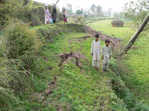 |
Photo g-05 (Loc. 304) Southwest-facing monoclinal scarp along the base of a distinctive preexisting fault scarp on the M surface, north of Phulhotar da Katha. Looking southeast. Photo taken by H. Tsutsumi, on March 13, 2006. |
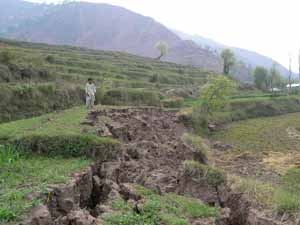 |
Photo g-06 (Locs. 304-305) Southwest-facing monoclinal scarp extending southwestward, along the base of the preexisting warp, north of Phulhotar da Katha. Looking southwest. Photo taken by H. Tsutsumi, on March 13, 2006. |
 |
Photo g-07 (Loc. 310) Southwest-facing monoclinal scarp in paddy fields on the right bank of Phulhotar da Katha. Looking northeast. Photo taken by H. Tsutsumi, on March 13, 2006. |
 |
Photo g-08 (Loc. 315) South-facing monoclinal scarp in cultivated fields, south of Phulhotar da Katha. Looking north. The vertical separation is 1.05 +/- 0.15 m. Photo taken by H. Tsutsumi, on March 13, 2006. |
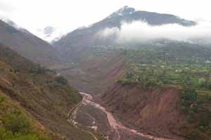 |
Photo g-09 (Locs. 331-334) Distant view of the valley of Jandarbain Katha (left) and the ~32-m-high cumulative fault scarp on the M terrace surface of Malsipain to the south (right). View northeast. The 2005 surface rupture appeared at the valley bottom and along the base of the cumulative fault scarp on the M surface. Cropped and annotated version of this photograph is shown in Figure 9c of the article. Photo taken by N. Sugito, on March 15, 2006. |
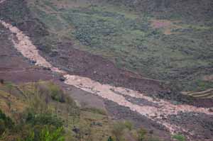 |
Photo g-10 (Loc. 331) Small waterfall formed where the fault crosses Jandarbain Katha. Looking east. The fault scarp is traced onto the grassy terrace surface on the right. Note that the east-dipping fault plane is expressed on the terrace riser as a narrow zone of fresh slope failure. Photo taken by N. Sugito, on March 15, 2007. |
 |
Photo g-11 (Locs. 331-332) Broad west-facing monoclinal scarp across the lowest terrace surface on the left bank of Jandarbain Katha. Looking north. The monoclinal scarp is associated with shortening features at its base and extensive tension cracks on its crest. Note small ponds on the farther right, which may reflect a slight back tilt. Two vertical separation measurements of 3.1 +/- 0.6 m (near Jandarbain Katha on the background) and 3.4 +/- 0.4 m (foreground) are made across this fault scarp. Photo taken by N. Sugito, on March 15, 2006. |
 |
Photo g-12 (Locs. 331-332) Extensive tension cracks formed on the crest of the monoclinal scarp in the valley of Jandarbain Katha. Looking northwest. Person is standing at the base of the scarp. Photo taken by H. Kaneda, on January 21, 2006. |
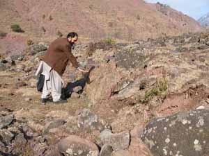 |
Photo g-13 (Loc. 331) Upright turf at the base of the monoclinal scarp in the valley of Jandarbain Katha. Looking north. Photo taken by T. Nakata, on January 21, 2006. |
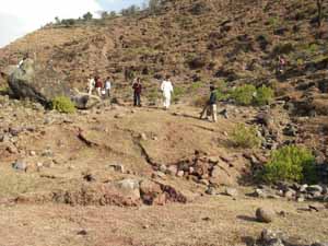 |
Photo g-14 (Loc. 332) Rolled-up or bulldozed turf at the base of the monoclinal scarp in the valley of Jandarbain Katha. Looking east. Photo taken by Y. Awata, on January 21, 2006. |
 |
Photo g-15 (Between Locs. 334 and 335) Scarp failures along the base of a preexisting fault scarp on the M surface at Malsipain. Looking north. Though not visible in this photograph, small amount of thrusting were also observed at the base of the failed scarp. Photo taken by N. Sugito, on March 15, 2006. |
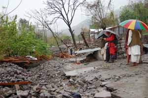 |
Photo g-16 (Loc. 340) Tilted concrete basement of a completely destroyed house at the base of a preexisting fault scarp on the M surface at Malsipain. Looking north. Photo taken by N. Sugito, on March 15, 2006. |