This electronic supplement contains color versions of Figures 1–4 from the main article as Figures S1–S4, with captions duplicated from the main text. A self-contained Google Earth (KMZ) file of our observations contains embedded photographs from each location.
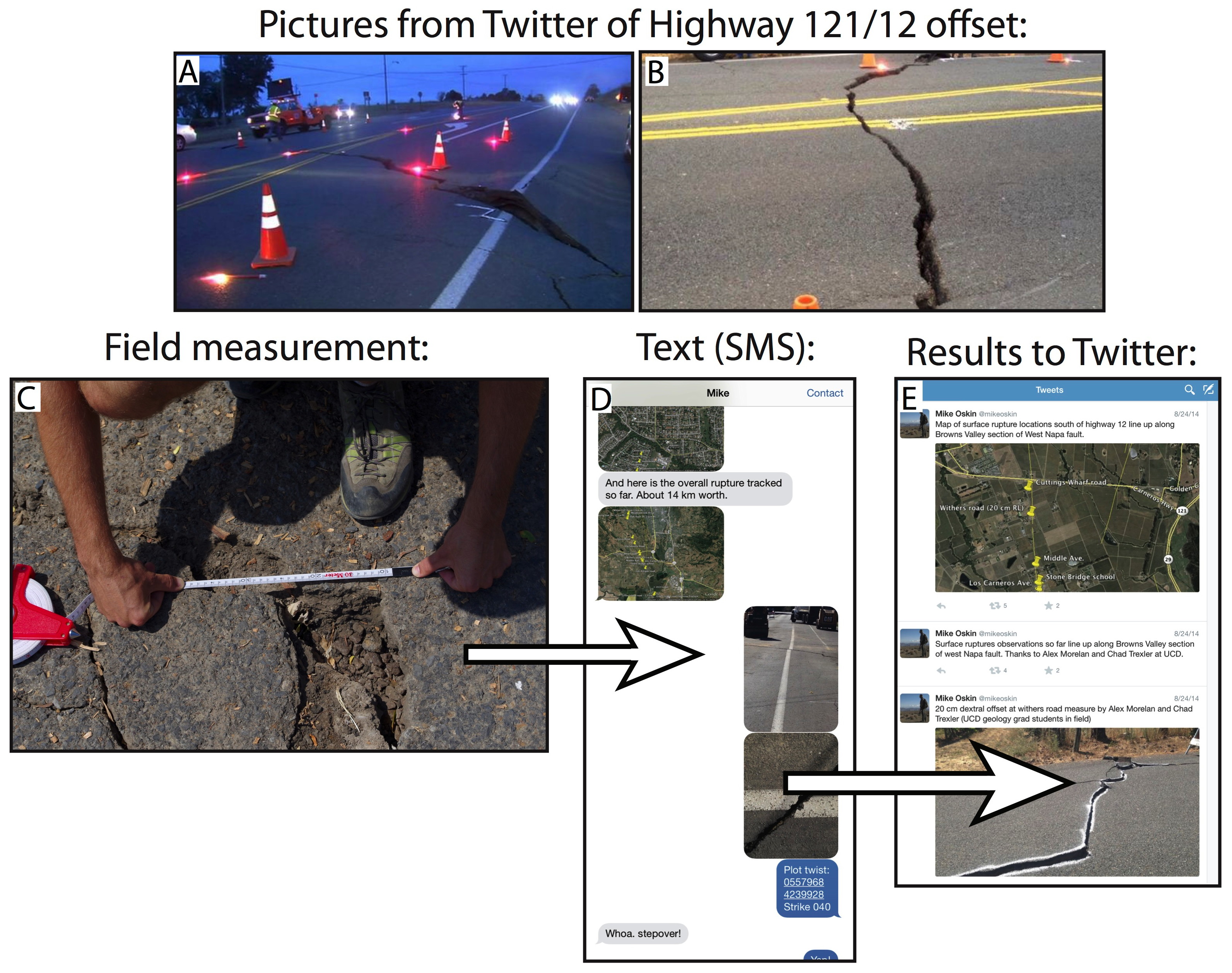
Figure S1. Rapid rupture mapping workflow. (a and b) Images of offset on highway from social media motivated the mobilization of the University of California Davis field team. (Photograph credit: (a) ABC7; (b) Ceci Tamsen.) (c and d) The field team collected photographs, displacement measurements, and UTM coordinates, and communicated with the office team member via text messaging. (e) The office team plotted locations in Google Earth, sent these maps to the field team, and broadcasted results in real time on Twitter.
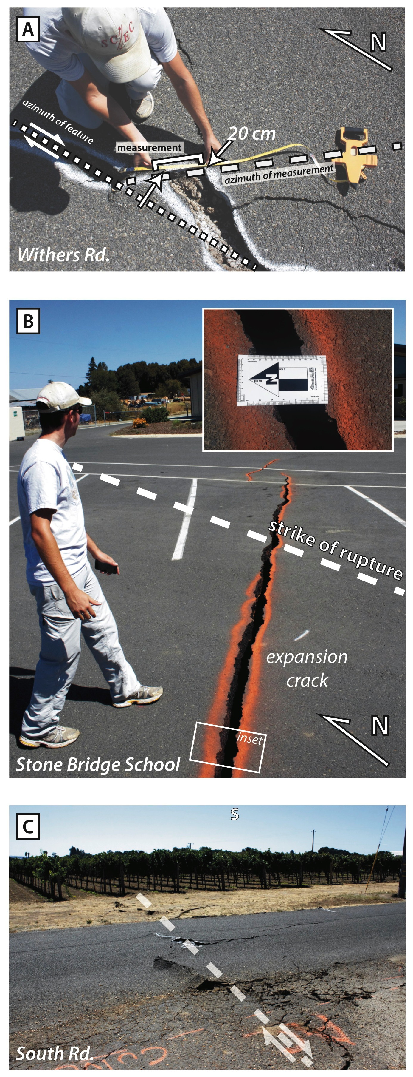
Figure S2. Field photographs of the rupture south of SR 12/121 taken on the day of the 24 August 2014 South Napa earthquake. White lines show the local surface-rupture trace. White arrows in (a) and (c) indicate the piercing line or point where each measurement was taken. (a) Offset asphalt on Withers Road. (b) Extensional cracks in the parking lot of Stone Bridge School. (c) Surface rupture across South Road.
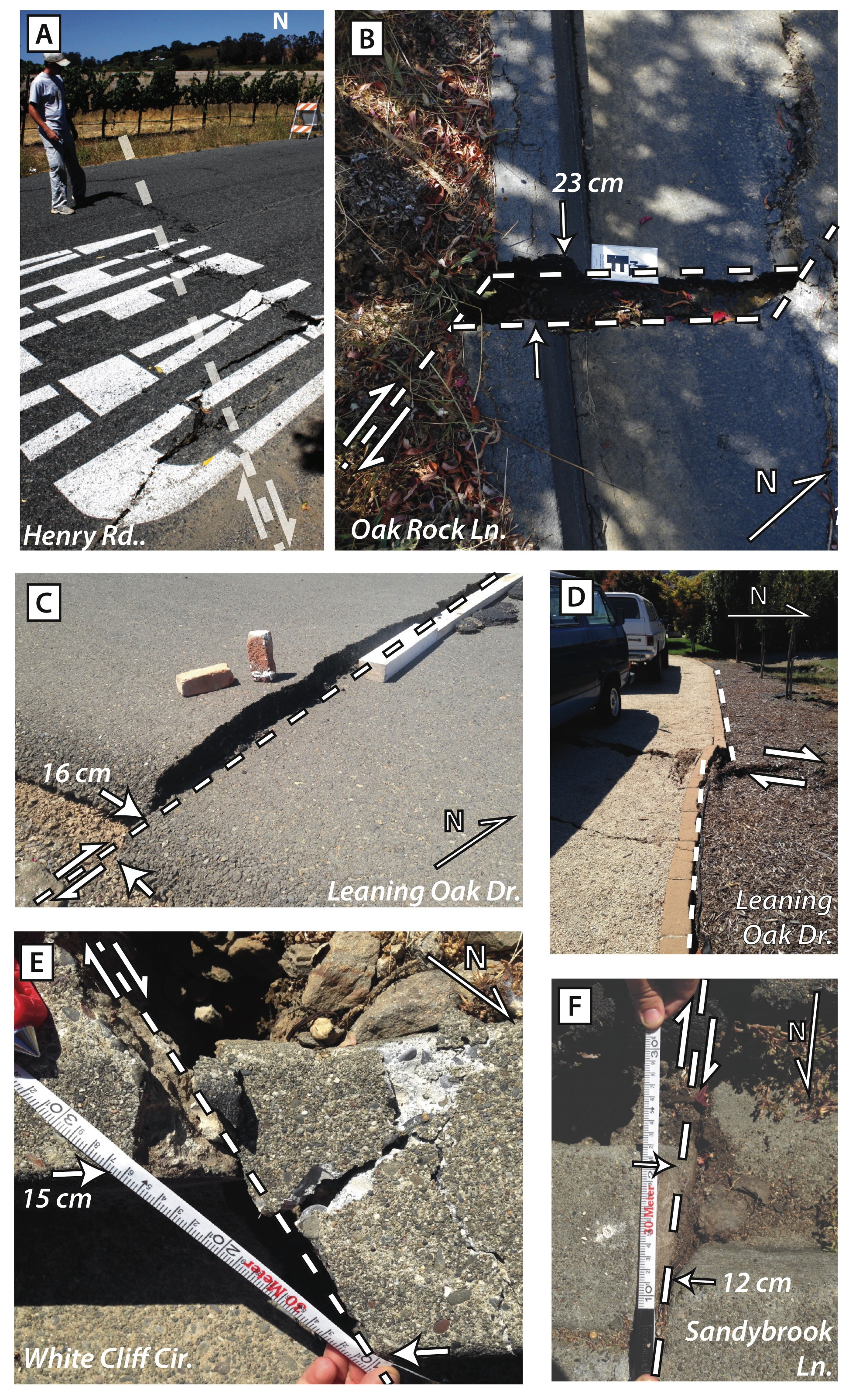
Figure S3. Field photographs of the rupture north of SR 12/121 taken on 24 August 2014. White lines show the local surface-rupture trace. White arrows in (b), (c), (e), and (f) indicate the piercing line where each measurement was taken. (a) Henry Road, where rupture did not produce a measurable offset in the road despite measurements of >20 cm both to the north and south of this site. (b) Oak Rock Road, site of our largest first day offset measurement of 23 cm. (c) Leaning Oak Drive, where a measurement was taken adjacent to a rotated block of asphalt and thus represents a minimum dextral offset. (d) Warping and offset of a brick curb along a driveway at Leaning Oak Drive. (e) Offset curb at White Cliff Circle. (f) Offset curb at Sandybrook Lane.
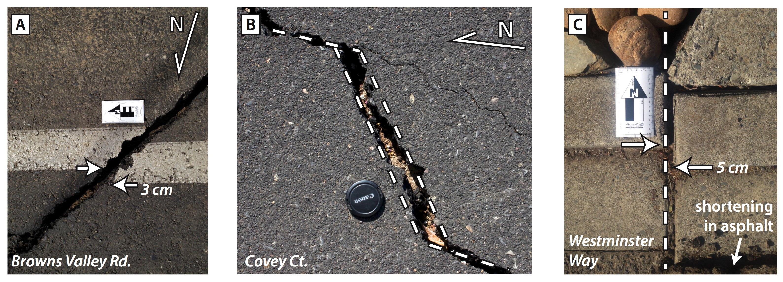
Figure S4. Field photographs on the second rupture strand east of the primary surface rupture, taken 24 August 2014. White lines show the local surface-rupture trace. White arrows in (a) and (c) indicate the piercing line where the measurement was taken. (a) Offset in asphalt on Browns Valley Road. (b) Offset asphalt on Covey Court. (c) Offset curb on Westminster Way. Note the shortening in asphalt at the bottom of the image.
Download: srl_morelan_napa.kmz [compressed keyhole markup language file; ~99 MB]. A compressed, self-contained Google Earth (KMZ) file of our observations contains embedded photographs from each location. Google Earth is available at http://www.google.com/earth/download/ (last accessed April 2015).
[ Back ]