This electronic supplement contains Google Earth images of the region of the Ludian Mw 6.2 earthquake.
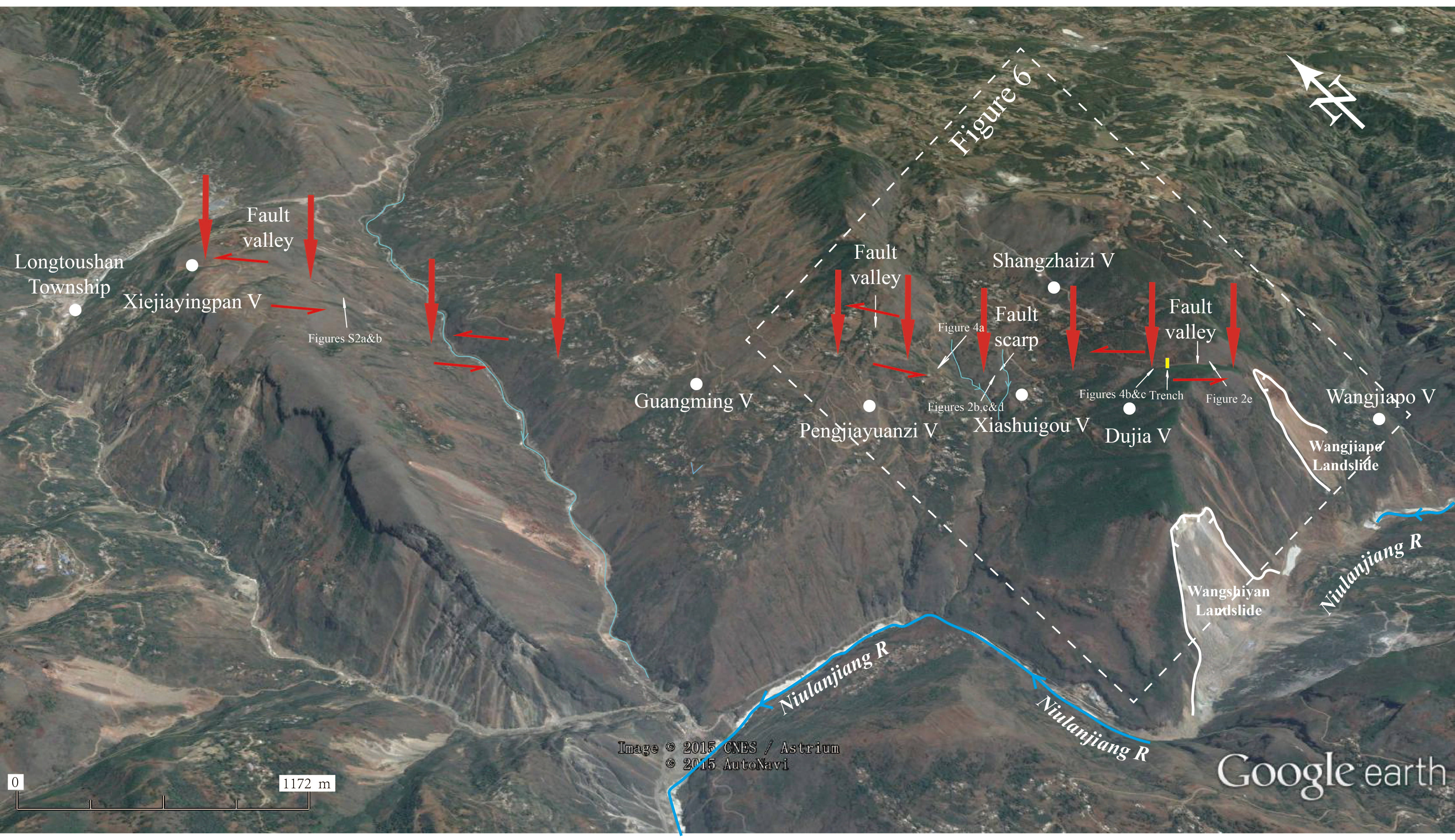
Figure S1. Traces of the northwest-trending Baogunao–Xiaohe fault demonstrated on the satellite image by Google Earth (image was taken on 5 May 2015 after the Ludian earthquake). Red arrows point to the obvious morphologic expressions of the Baogunao–Xiaohe fault, which are demonstrated by the northwest-trending fault valleys, fault scarps, discontinuous linear features, and the west–northwest-trending fault plane dipping 65° E (Figs. 4a and 9a–c in the main article). The offset ranges show that the fault is basically left-lateral with normal component (west side up). The primary surface ruptures are mainly observed between the two southern fault valleys. The yellow rectangle near Duija Village represents the location of the trench that was excavated across the earthquake surface rupture zone. The locations of Figures 2, additional parts of 4, and 6 (in the main article) are also indicated.
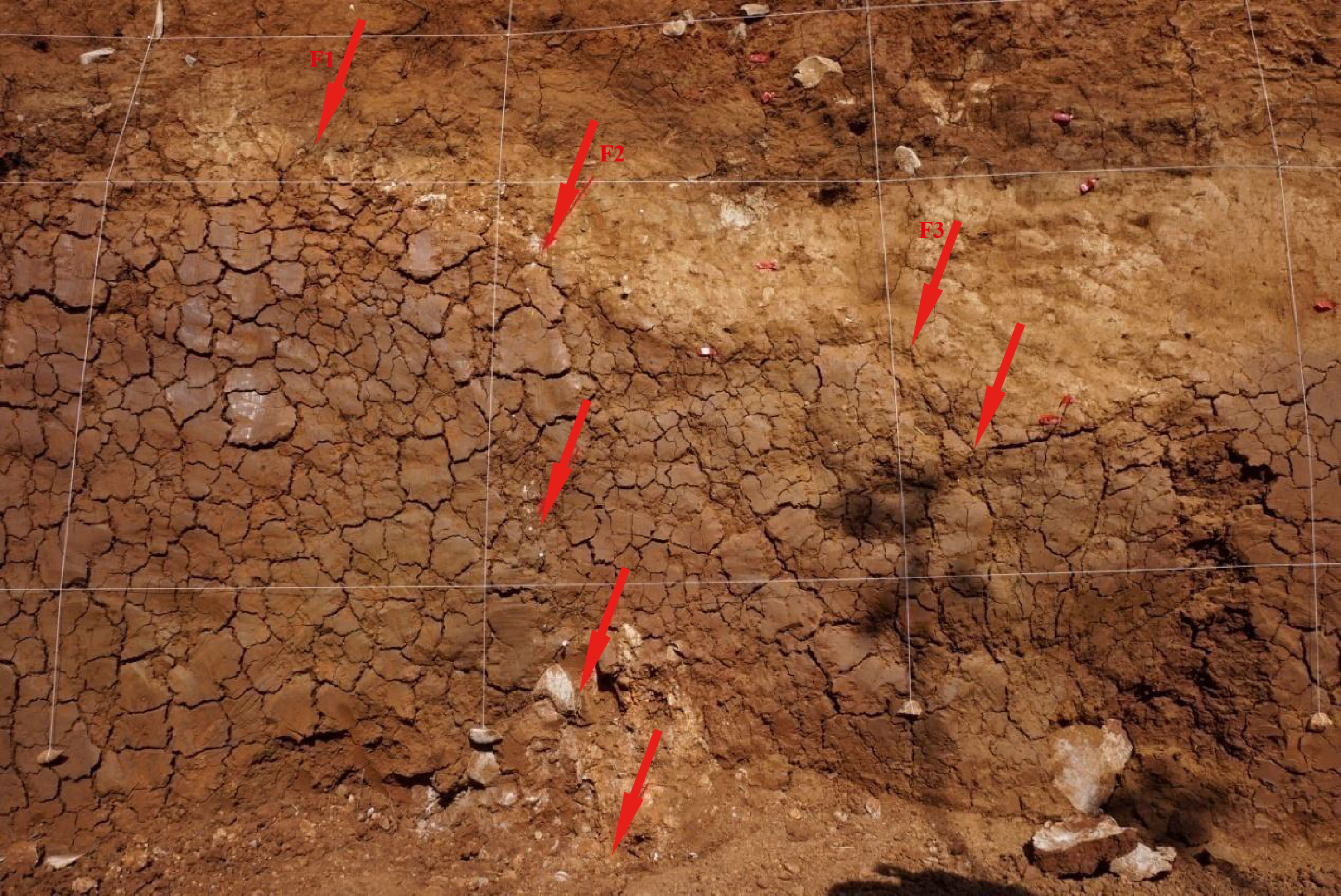
Figure S2. Close-up view showing geological evidence of the F2 fault branch on the northwestern exposure wall of the trench, which is witnessed by imbricated gravels.
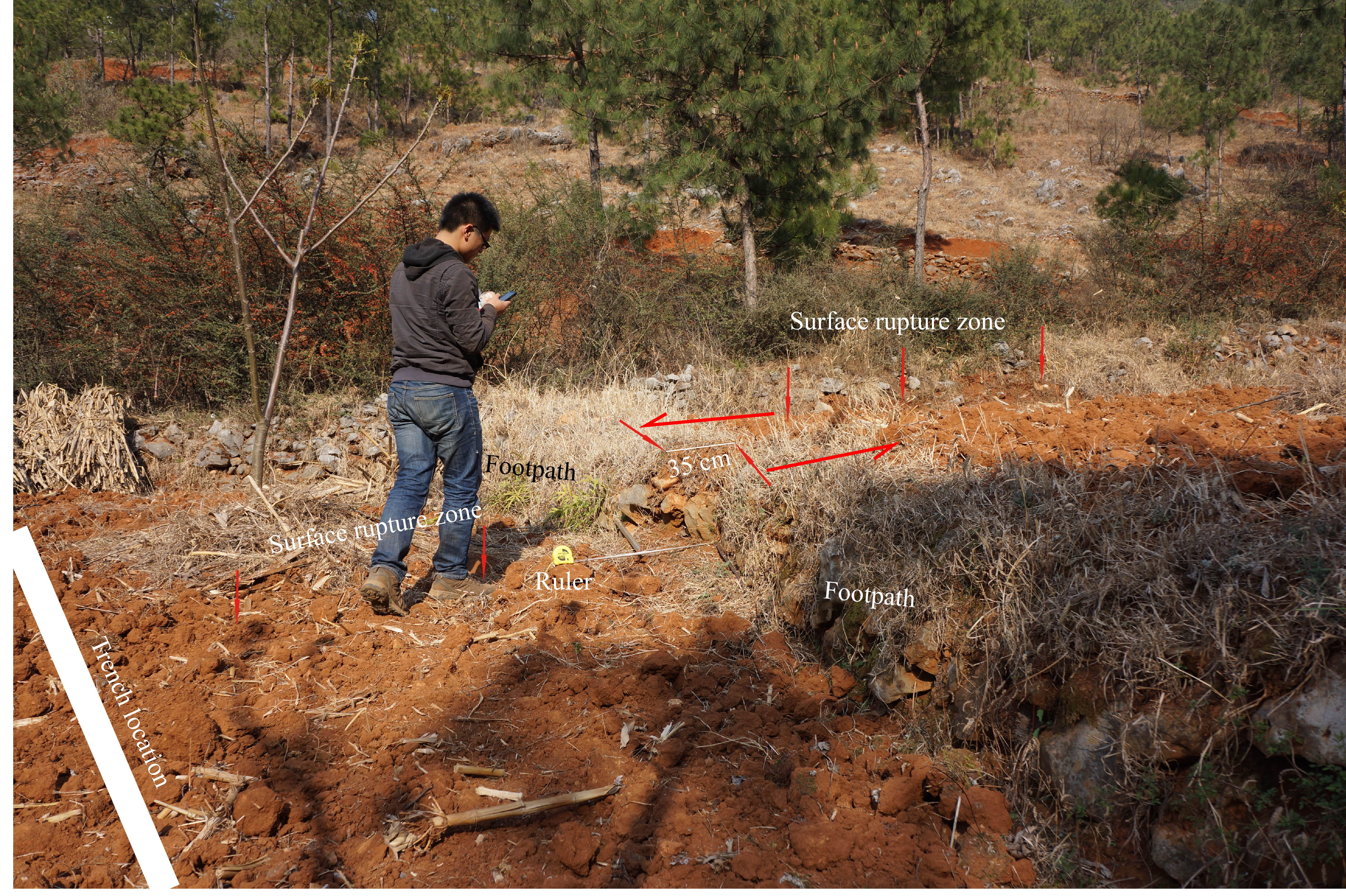
Figure S3. Photograph showing a footpath in the field several meters southeast of the trench was offset ~35 cm in the left-lateral sense. The view is to the east.
[ Back ]