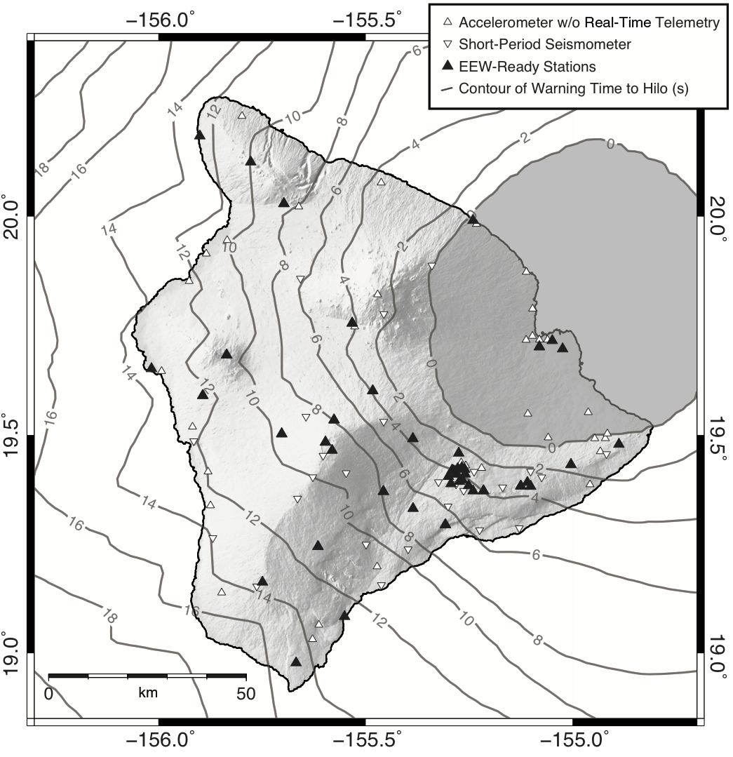
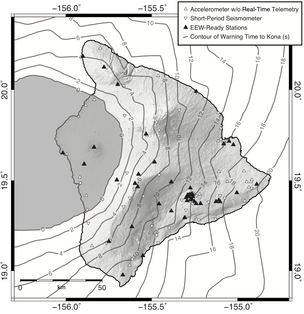
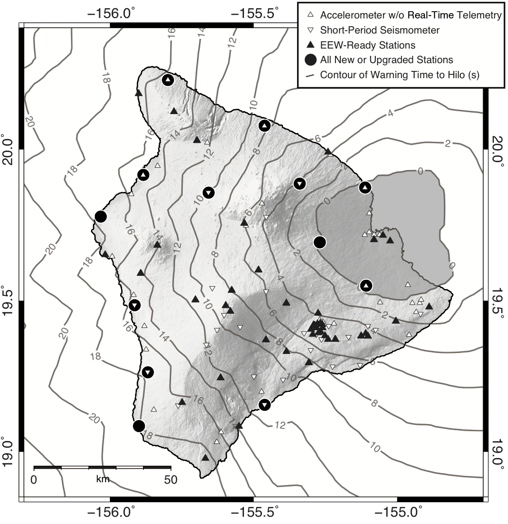
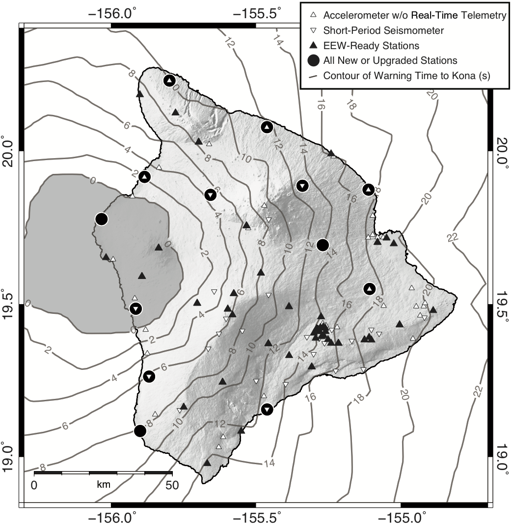
This electronic supplement contains figures showing estimates of warning time to Hilo and Kailua-Kona—in the same format as Figures 2 and 4 in the main article for Mauna Kea—both before and after adding additional stations to bolster the earthquake early warning (EEW) network. Warning time as visualized here is the time between identification of a source occurring anywhere on the map and the arrival of S waves from that source to the point of interest. Source locations within the 0 s contour are in the blind zone, where no warning will be possible.
Figure S1. Map of approximate warning time to Hilo from sources around the island of Hawaiʻi, using the current network configuration and latencies.
Figure S2. Map of approximate warning time to Kailua-Kona from sources around the island of Hawaiʻi, using the current network configuration and latencies.
Figure S3. Map of approximate warning time to Hilo from sources around the island of Hawaiʻi, using the proposed network configuration and approximated latencies.
Figure S4. Map of approximate warning time to Kailua-Kona from sources around the island of Hawaiʻi, using the proposed network configuration and approximated latencies.
[ Back ]