Electronic Supplement to
Surficial Slip and Rupture Geometry on the Beichuan Fault near Hongkou during the Mw 7.9 Wenchuan Earthquake, China
by Jing Liu-Zeng, Li Wen, Jie Sun, Zhihui Zhang, Guyue Hu, Xiucheng Xing, Lingsen Zeng and Qiang Xu
Selected photos of the surface rupture in the Shenxi Gou section
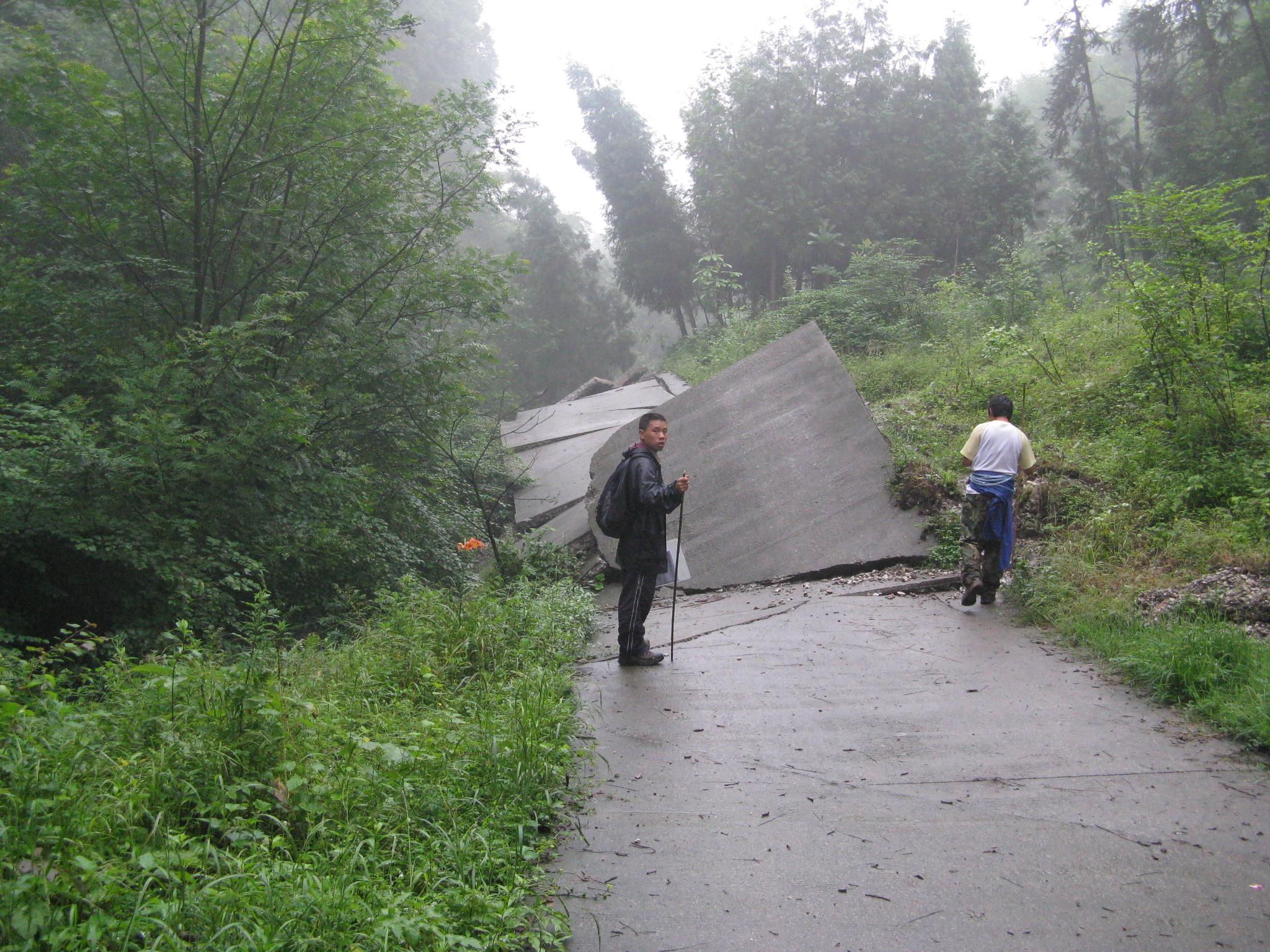
Point 618007
The flat paved road was tilted sideway to nearly vertical. Scarp height is larger than 2.8m. Fault striking N55E. Looking southwest. Photo taken by W. Li, on June 18, 2008.
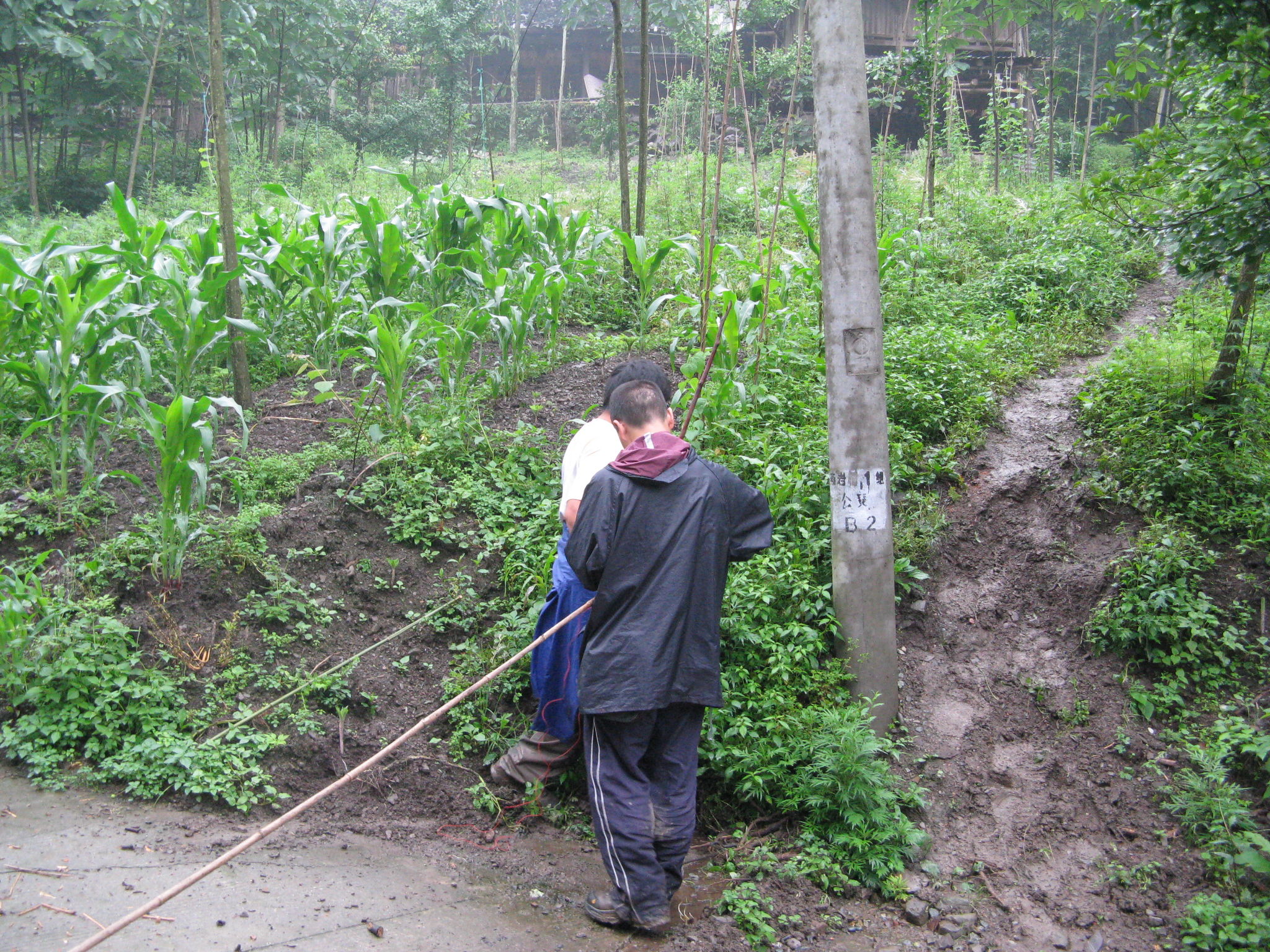
Point 618008
The corn field next to the paved road was uplifted. Looking north. Photo taken by W. Li, on June 18, 2008.
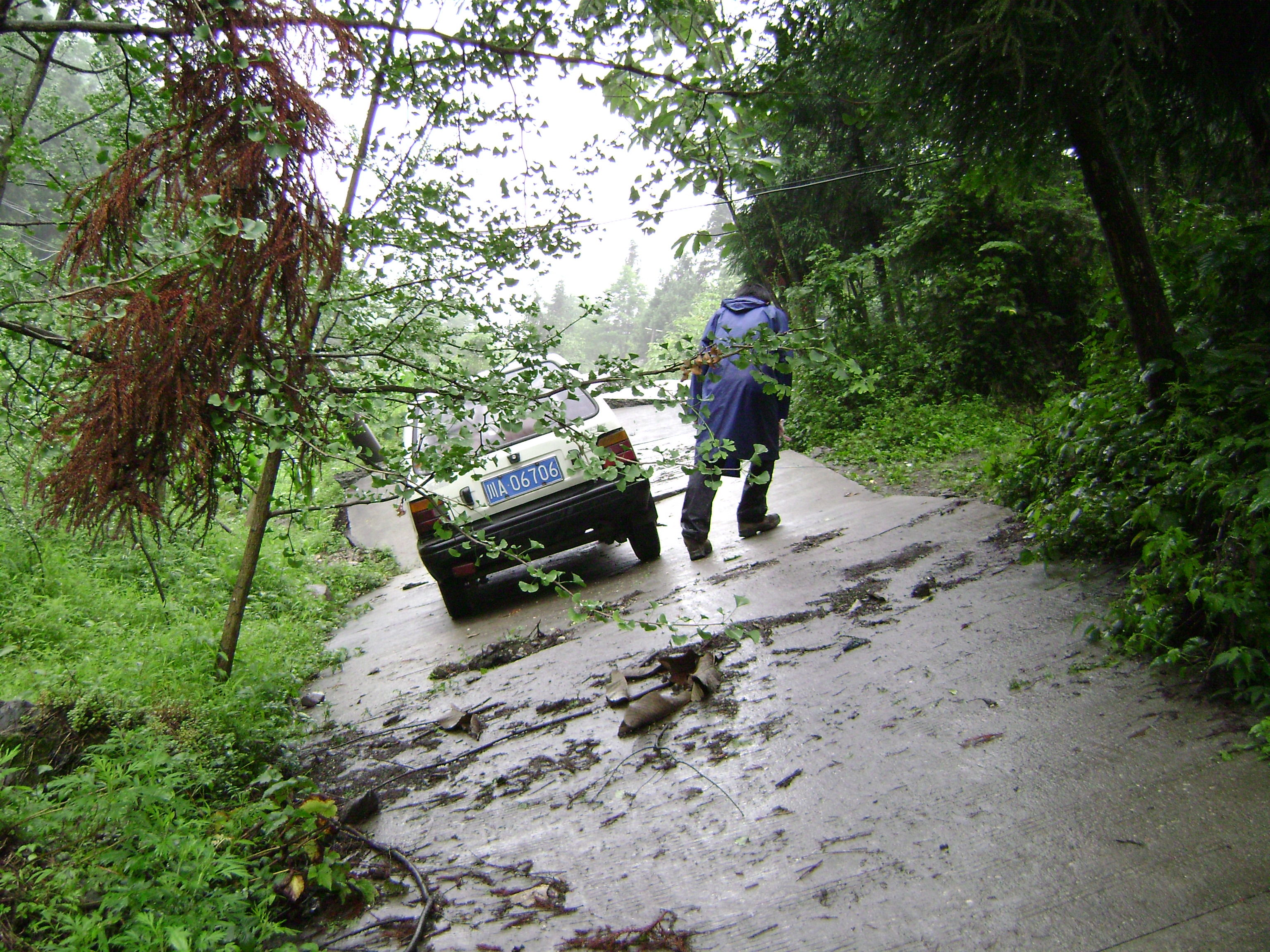
A few tens of meters southwest of point 243-b
The paved road, which was almost parallel to the fault scarp, was tilted. The abandoned car was not overturned on the tilted road, which possibly suggests the ground uplifting speed at the site was mild. Looking southwest. Photo taken by W. Li, on June 18, 2008.
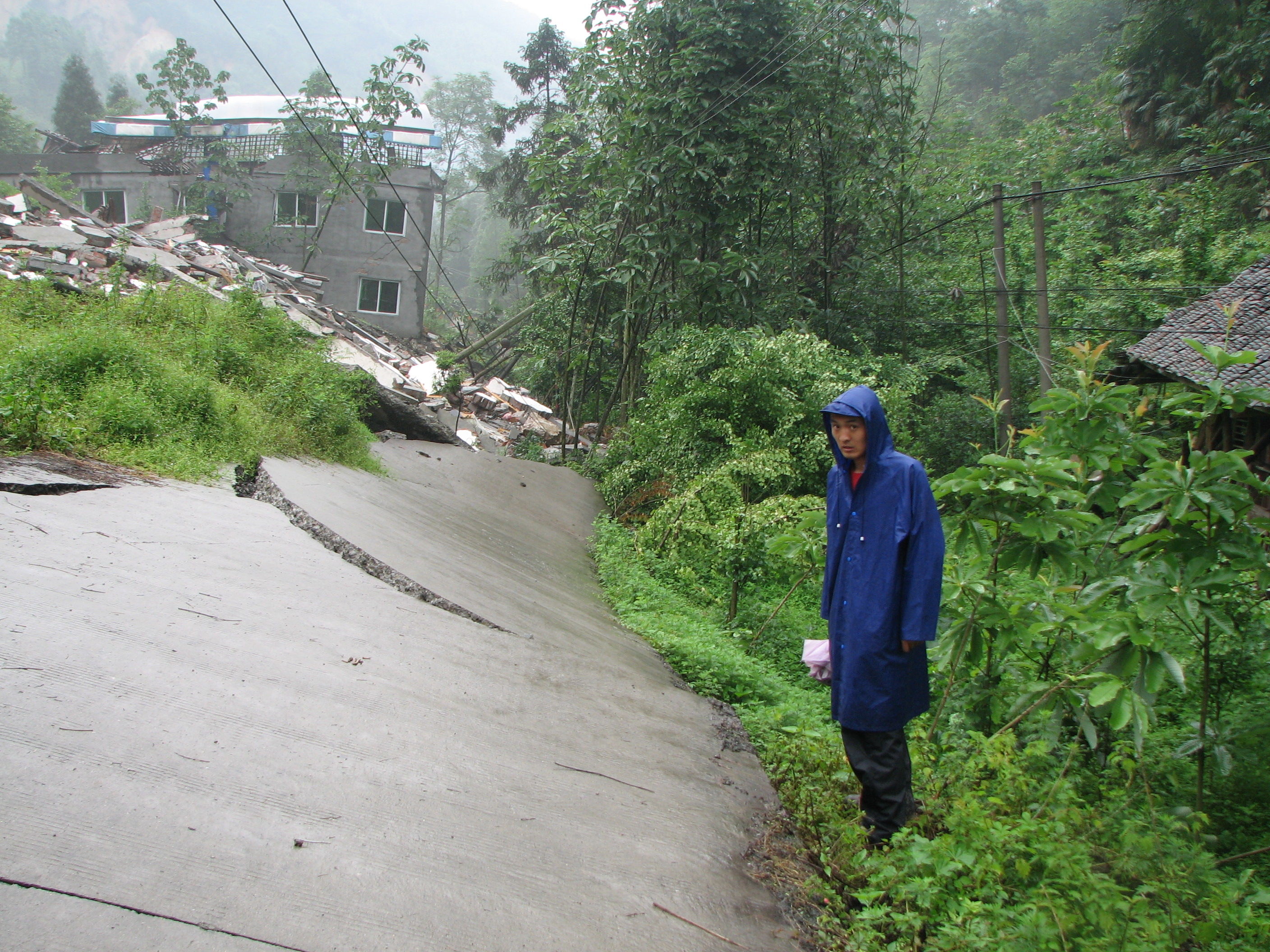
Point 243b
The 5.2m high fault scarp runs almost parallel to a concrete tourist drive road, which was tilted, NW-side up. The wooden-framed storage-room on the footwall still stood and coherent, most of the tiles on the roof did not fall either. Looking northeast. Photo taken by J. Liu-Zeng, on June 18, 2008.
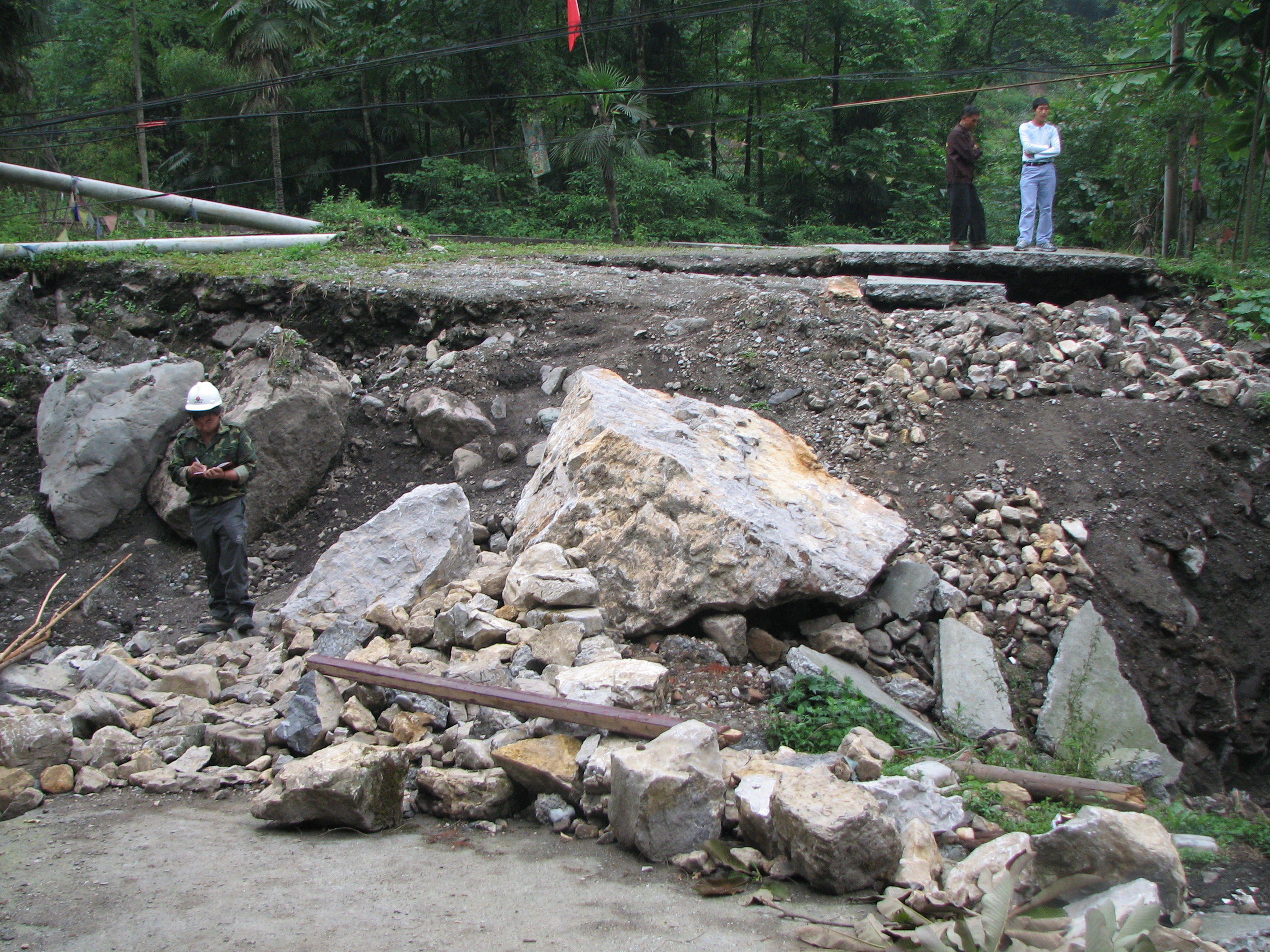
Point 243
Fault runs parallel to a gulley, and cut through a villager's driveway, and uplifted the NW side by 2.8m. Looking north. Photo taken by J. Liu-Zeng, on June 18, 2008.
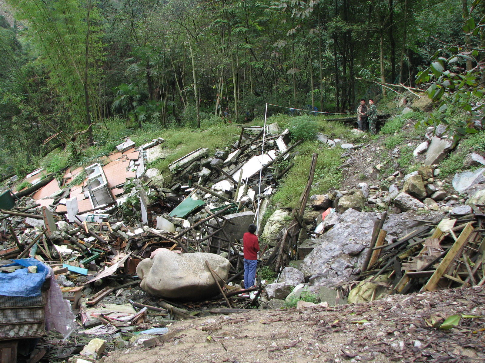
Point 628002
Fault cuts through a villager's yard, and formed a NW side-up scarp that was measured 5.1m. Direct measurement was 6.0 m, but the owner of the house pointed out that there was a pre-existing topographic step at the position of the fault scarp, where they built a three-step staircase, therefore a 0.9 m was subtracted to account for the pre-earthquake topography. Looking north. Photo taken by J. Sun, on June 28, 2008.