Figures for
A Regional View of Urban Sedimentary Basins in Northern California based on Oil Industry Compressional-Wave Velocity and Density Logs
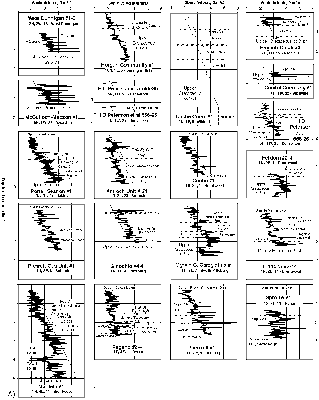
Figure A1. Part A. All sonic log for oil test boreholes along the western side of the Great Valley. Dashed lines show average linear regression for the Great Valley logs. Figure format is identical to that of Figure 4.
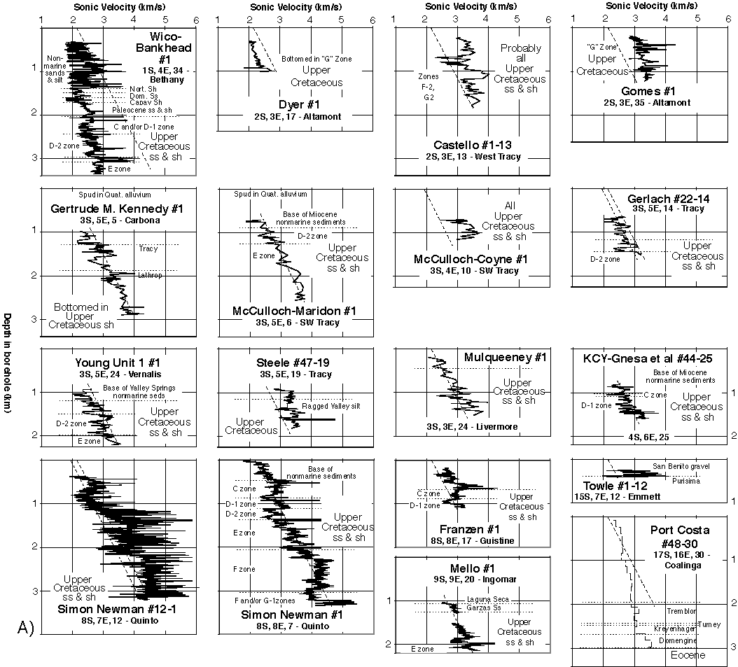
Figure A1. Part A continued. All sonic log for oil test boreholes along the western side of the Great Valley. Figure format is identical to that of Figure A1.
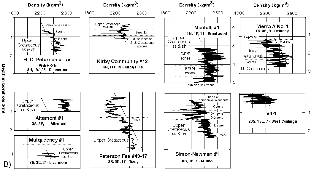
Figure A1. Part B. All density log for oil test boreholes along the western side of the Great Valley. Figure format is identical to that of Figure A1.
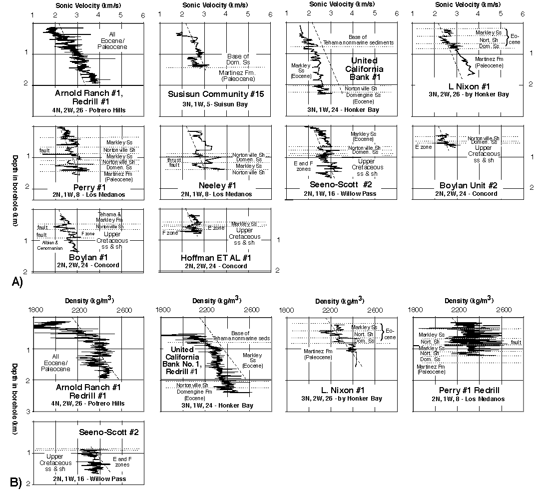
Figure A2. All sonic logs (A) and density logs (B) for boreholes in the vicinity of Suisun Bay in the western delta of the Sacramento River. Format as for Figure A1.
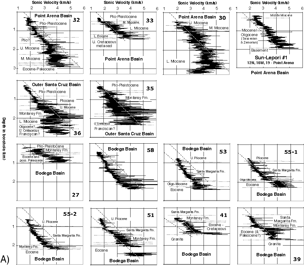
Figure A3. Part A. All sonic logs for oil test boreholes in the Point Arena, Bodega, and Outer Santa Cruz Basins, all located offshore (Fig. 1). Figure format is identical to that of Figure A1.
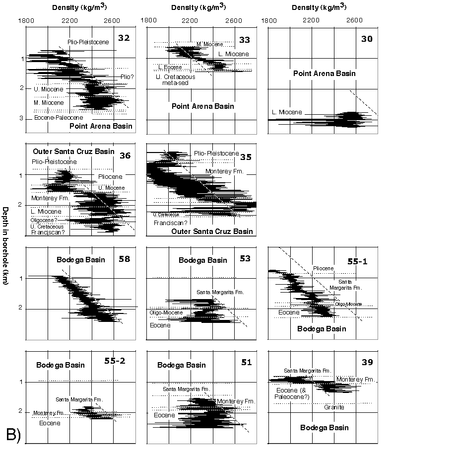
Figure A3. Part B. All density logs for oil test boreholes in the Point Arena, Bodega, and Outer Santa Cruz Basins, all located offshore (Fig. 1). Figure format is identical to that of Figure A1.
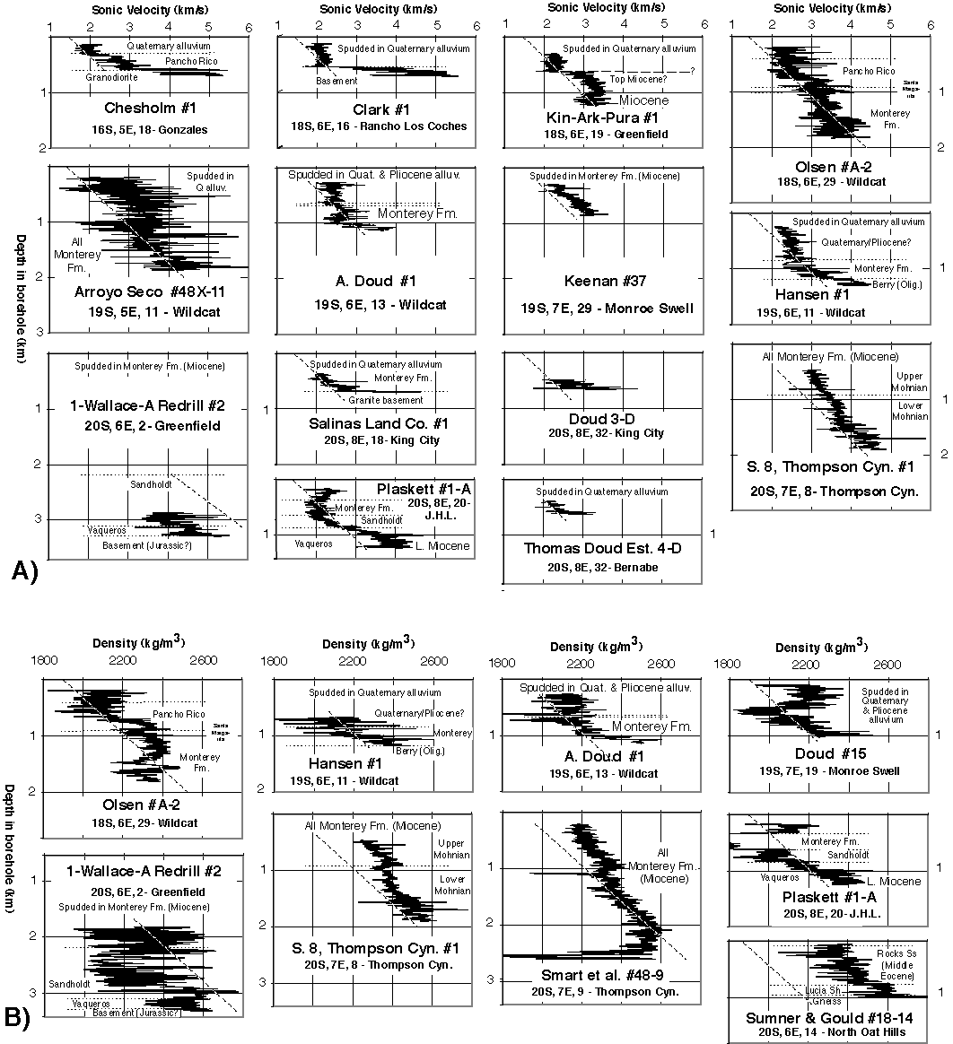
Figure A4. All sonic logs (A) and density logs (B) for boreholes from Salinas Valley. Format as for Figure A1. Thick mudcake noted between 360 m and 600 m depth for the Plaskett No. A-1 well is probably responsible for the lowered densities measured in this depth interval. Although I could not locate the subsurface stratigraphy encountered by the Keenan #37 and Doud #15 wells, several lines of evidence suggest that they sampled the Monterey Formation at depth. Keenan #37 spudded into Monterey Formation.
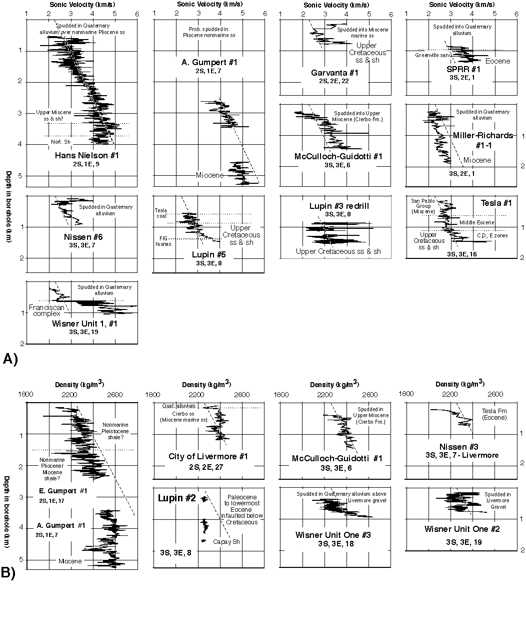
Figure A5. All sonic logs (A) and density logs (B) for boreholes from Livermore Valley. Format as for Figure A1.
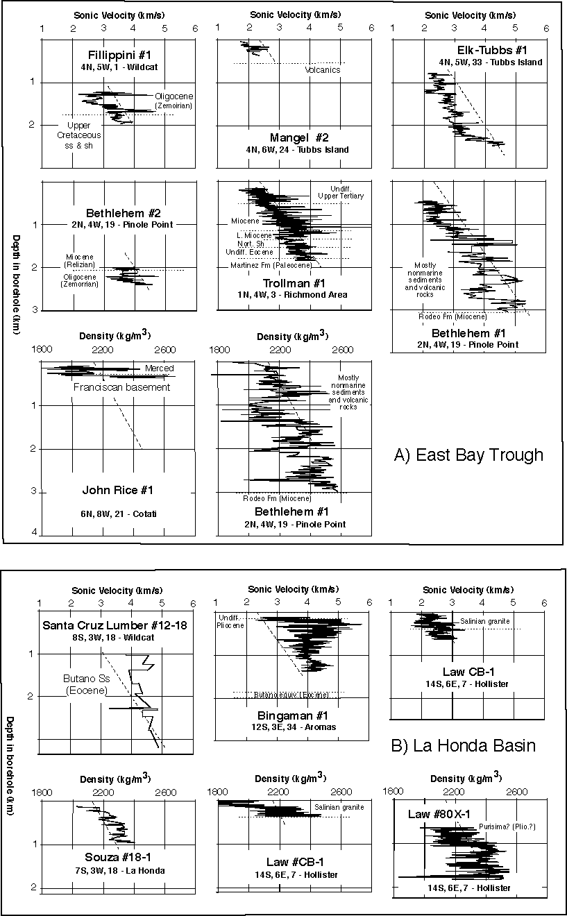
Figure A6. All sonic logs and density logs for boreholes within the (A) East Bay Trough and (B) La Honda Basin. Format as for Figure A1.
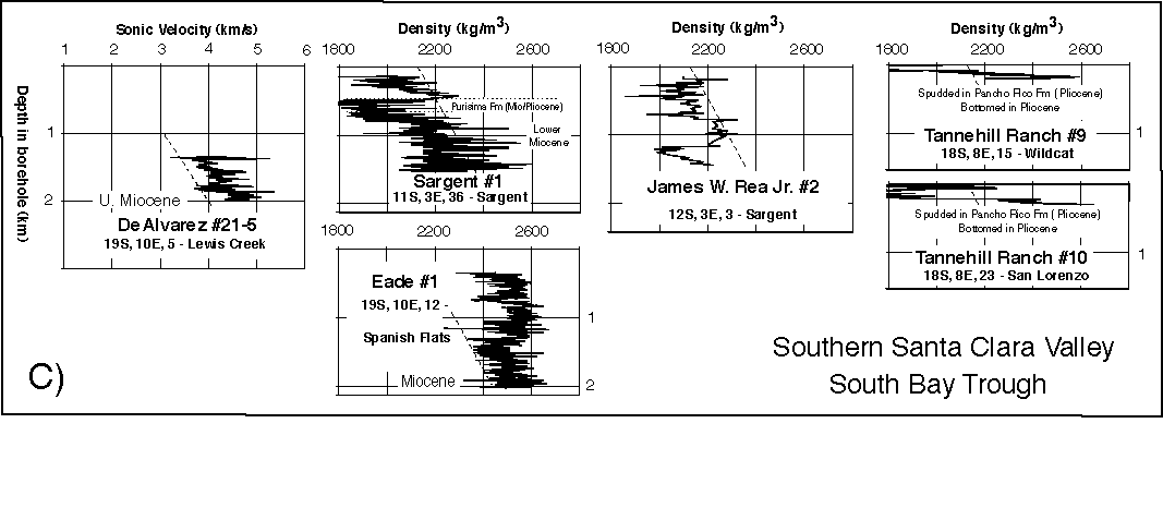
Figure A6 continued. All sonic logs and density logs for boreholes within the (C) southern Santa Clara Valley and South Bay Trough. Format as for Figure A1.