Photo Gallery of Surface Rupture Evidence from the
Kunlunshan Earthquake of 14 November 2001
Page 2 * (Photos 8-14)
|
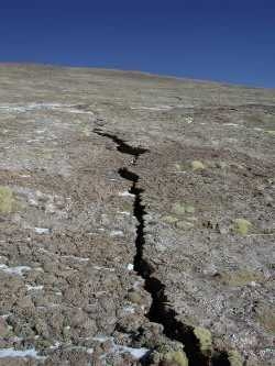
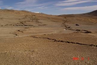
Photo 8. N60°E-trending sawlike tensile rupture at the easternmost end 70 km east of Kunlunshan Pass, showing disappearance eastward (photo toward the northeast). |
|
Photo 9. East of Buka Daban Fen, the main surface rupture zone bifurcates westward. The left-lateral one still strikes N85°W and stops at the easternmost lobe east of Buka Daban Feng. The other one is tensile and strikes 215º with a normal component, showing it is northwest down and southeast up (photo toward the west). |
|

|
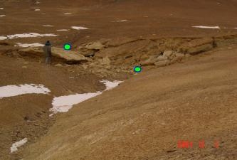
Photo 10. A tensile surface rupture 2 km east of Buka Daban Feng trending 215º and showing only 1.2 m normal throw and no strike-slip component (photo toward the south). |
|
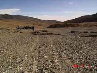
Photo 11. A N85ºW-trending pure shear fracture or strike-slip fault with a surface width of 12.5 m offset a south-flowing gully 6 m in a left-lateral sense (photo toward the north). |
|
|
Photo 12. The N73ºE-trending fractures are right-stepping where mole tracks are (photo toward the northwest). |
|
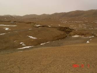
Photo 13. The surface ruptures near the macroscopic epicenter, about 83 km west of Kunlunshan Pass, consist of four strands about 74 m wide with a total left-lateral displacement equal to or larger than 5.6 m (photo toward the east). |
|
|
Photo 14. The southernmost strand of surface ruptures in Photo 13, about 11.3 m wide, trends N80ºE and offset by 1.75 m a car track left before the earthquake (photo toward the south). |
[Photos 1-7] [Photos 8-14] [Photos 15-21]