Photo Gallery of Surface Rupture Evidence from the
Kunlunshan Earthquake of 14 November 2001
Page 3 * (Photos 15-21)
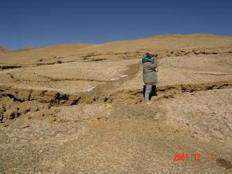 |
Photo 15. The second strand from the south in Photo 13 offset a small channel 1.55 m horizontally (photo toward the south). |
| Photo 16. The third strand from the south in Photo 13 strikes about N76ºE and consists of a series of N76ºE-trending transtensional fractures which offset the risers and small channels about 2.3 m horizontally (photo toward the south-southeast). | 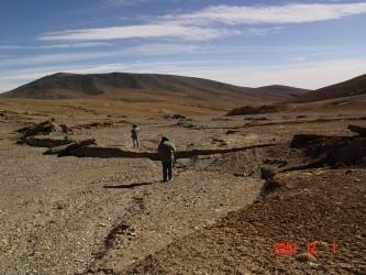 |
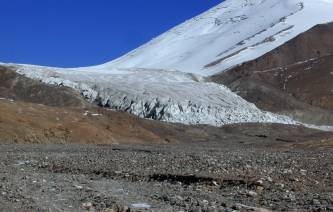 |
Photo 17. The earthquake surface ruptures cut the glacial lobe front to form a broken zone 23 m wide at the southern piedmont of Yuzhu Feng, a snow-capped summit with an elevation of 6,178 m (photo toward the north). |
| Photo 18. Pre-earthquake fault scarp, which was produced by paleo-offsets, faces to the north that blocked a south-flowing stream to form a sag pond at site H, north of Hoh Sai Hu Lake. The latest surface ruptures are overprinted on this scarp, showing how a scarp has formed (photo toward the southwest). | 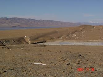 |
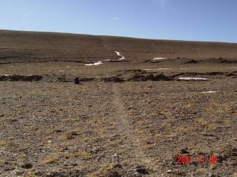 |
Photo 19. Five subparallel ruptures are on the pre-earthquake fault scarp or in front of it. These ruptures are left-lateral slip with a total offset of 4 m. The small single tracklike road left by wild donkeys is offset in a left-lateral sense (photo toward the south). |
| Photo 20. The earthquake surface rupture zone consists of three subparallel ruptures about 12 m wide which offset the northern shoreline of Hoh Sai Hu Lake 4.7 m in a left-lateral sense (photo toward the north). | 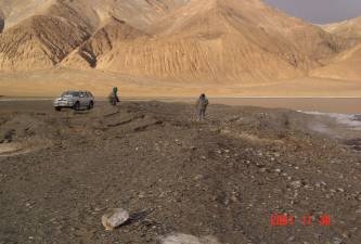 |
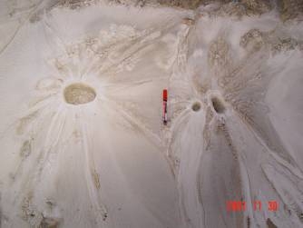 |
Photo 21. Ice cones occur near the surface ruptures on the northern shoreline of Hoh Sai Hu Lake, the same origin as liquefied sand cones (photo toward the south). |
[Photos 1-7] [Photos 8-14] [Photos 15-21]