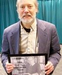
 The Frank Press Public Service Award was presented to Art Frankel at the 2010 annual meeting in Portland, OR. Since being tasked with leading an update to national seismic hazard maps for the United States Geological Survey (USGS) in 1993, Art Frankel has contributed significantly to improved public policy, building codes and earthquake safety across the United States.
The national seismic hazard maps that Frankel and USGS colleagues developed under his leadership were the first to be used directly in the seismic provisions of building codes. Within three years, Art had led the development of new national seismic hazard assessments based on hazard values for about 150,000 gridded sites nationwide. Frankel not only expanded the scientific methodology behind the maps, he also established and carried out essential consensus-building procedures for gathering expert opinion and feedback to ensure confidence in the process and for spurring improved communication between the seismology and engineering communities.
The national seismic hazard maps developed through Art’s efforts draw upon a wide body of results from geological research and earthquake monitoring supported by the National Earthquake Hazards Reduction Program (NEHRP). The hazard maps are used as the definitive basis for seismic design maps, which are in turn used in the seismic safety elements of model building codes adopted by more than 20,000 cities, counties and communities in the US. Frankel has also further applied his research and leadership skills in developing finer scale, urban hazard maps that take into account site conditions and other local geologic features.
The work of Frankel and colleagues has provided the basis for a new standard of building codes nationwide that are promoted by FEMA and other organizations. In recent years, Frankel has turned over the reins of the national hazard project and focused on developing techniques for urban and regional seismic hazard assessments that account for soil conditions and non-linear site response, three-dimensional basin effects and fault rupture directivity. In this work he has focused, most appropriately for this meeting of the SSA, on the Seattle and Portland areas.
