15 April 2026—When the edge of a Greenland glacier breaks off into the sea to become an iceberg, can a global seismic network “hear” it?
The answer is yes—but only if the event is a large one. And it helps to pair the resulting surface seismic waves with satellite observations to get the best overall chance at detecting calving tidewater glaciers, researchers said at the 2026 SSA Annual Meeting.
Researchers can use pairs of satellite images for “almost perfect geolocation of calving events,” said Adrian Borsa, a professor of geophysics at the Scripps Institution of Oceanography at University of California, San Diego. But the images can’t be used to narrow down the exact timing of the event beyond two to three days, and can’t be used to distinguish multiple calving events in that time.
“Conversely, seismic methods provide exception temporal resolution for larger events that they can detect, with the ability to record successive calving events hours apart at a single glacier,” he said.
Large ice loss events such as glacial calving are becoming more frequent in a warming world. Learning more about how often these events happen, where they are located and what factors lead to that final fracture of the ice are important to understanding future sea level rise and potential regional effects such as tsunamis.
Glacial calving can produce strong surface wave energy to be detected by global seismic networks, but these events are often missed or misidentified in earthquake catalogs. To detect and characterize calving events on Greenland’s west coast, Borsa and his colleagues used data collected by the 400-station U.S. Array in the United States in 2019, when the portable array was still operational.
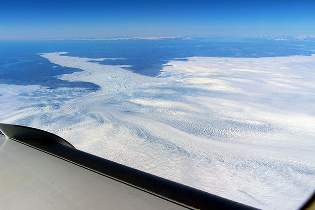
“Our observations suggest that calving events must be quite large for detection by global seismic arrays,” equivalent to magnitude 3.9 to 5.5 earthquakes, Borsa said, with a calving area of 0.3 to 1.8 square kilometers.
But satellite data can detect calving events that are “as much as two orders of magnitude smaller than those we believe are seismogenic,” he noted.
“Interestingly, our observations suggest little or no relationship between seismic magnitude and calving area or size, other than there appears to be a threshold calving size necessary for seismic detection,” said Borsa. “This is perhaps not a surprise, since the efficiency of calving energy transfer to the solid earth is likely to be glacier-dependent, for example, related to the distance of the calving front to the glacier grounding line, or the dynamics of the calved block once it is in motion.”
Now that they have a complete seismic and satellite image calving catalog for western Greenland, the next step is to look for signals that might predict a calving event before it happens, Borsa said.
“Imaging provides superb information on the spatiotemporal distribution of sea ice and melange in front of glacial termini, as well as the instantaneous speed of the upstream glacier prior to calving events,” he noted. “Both are part of a feedback loop between calving and the state of the glacier system in which it is occurring.”
One of the difficulties in identifying calving events in seismic data, said study co-author and Scripps geophysics professor Wenyuan Fan, is that the amplitude of their arriving seismic wave signal gradually builds out of background seismic noise. “They lack clear body-wave phases, making them difficult to identify using conventional approaches.”
Also at the SSA meeting, Scripps postdoctoral researcher Fengzhou Tan described how he and his colleagues are using machine learning to search for glacier-related seismic events in Greenland, and Thanh-Son Phạm, a seismologist at Australian National University, described a calving detection algorithm based on regional surface waves for in Thwaites Glacier, West Antarctica.