17 May 2021–Some days you can’t see the forest for the trees—and some days, you don’t want to see either one. For earthquake geologists like Emily Kleber, getting at the ground beneath all the distractions is the goal for learning more about natural hazards.
Kleber, a project geologist with the Geologic Hazards Program at the Utah Geological Survey, is an expert in using lidar and high-resolution topography. Lidar (light detection and ranging) uses a scanner that sends out millions of light pulses that reflect off the surface being scanned. A resulting set of data points represents both where and how well the light reflected off objects in the scanned area. “Data processing can classify points to determine what the light reflected off of, like trees, water or buildings, so points not only have a very accurate 3D position, but also can be sorted to show what the light reflected off of,” she explained.
Researchers can then extract certain points—all the points representing the ground, for instance—to make a model of a surface called a digital elevation model or DEM. “With a DEM of only ground points, it’s then possible to see and interpolate the ground without distraction,” Kleber said. “This is the real utility for geoscientists who think about how the surface is shaped by natural hazards like earthquakes, landslides and floods.”
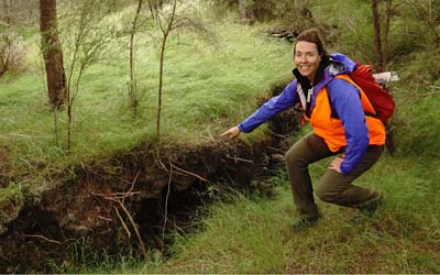
Kleber also uses high-resolution topographic data collected by airplanes or drones to look at ground features created by past earthquakes, mostly in the Intermountain West. She and her colleagues at the Utah and Idaho Geological Surveys, as well as the U.S. Geological Survey, combine the topographic data with visits to the actual faults to better understand the history and potential future of earthquakes in the region.
“We also have special study zones that we delineate for these fault-mapping projects,” she said, “as areas we recommend for additional geotechnical investigations for surface fault rupture hazards on new building projects.”
Kleber got hooked on geology during her first undergraduate quarter at the University of California, Davis, after taking a class on the geology of national parks. After graduating from Davis, she worked for the Bureau of Land Management in coastal Oregon on engineering geology evaluations for timber roads.
“Coastal Oregon was one of the first large areas in the U.S. to be covered by lidar, which afforded me the ability to investigate landslides through the dense forest,” she said.
When the 2011 Tohoku earthquake struck Japan, “suddenly I was the expert in earthquakes in the room because of my geoscience degree, and I had to learn how to communicate hazards to my colleagues in a new way,” recalled Kleber. “It was an eye opener to the fact that many of the concepts in geosciences that become our intuitions as scientists are not inherent to most people.”
Kleber later honed her lidar expertise at the NSF OpenTopography facility at the San Diego Supercomputer Center and during her master’s degree work at Arizona State University.
“With OpenTopography, I became a technical expert, but also spent time learning about how to work collaboratively with computer scientists and software experts to problem solve and make the data portal more useful,” she said, “It was really fun and challenging, especially since I still felt very green out of undergrad.”
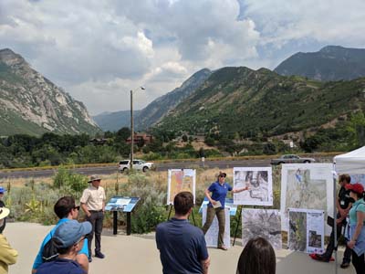
At the Utah Geological Survey, Kleber also works with the public outreach program and helps to organize small technical working group sessions on Utah earthquake research, as well as larger conferences such as the Basin and Range Province Earthquake Summit.
Part of Kleber’s job at the Survey is to respond to Utah geological emergencies, such as the March 2020 magnitude 5.7 Magna earthquake. “It was my first time responding to an earthquake, and it was a doozy, especially during the beginning of the pandemic,” she said.
The Magna sequence data are “already starting to change how we think about and model seismic hazards on the populated Wasatch Front,” said Kleber, who continues to work with emergency managers, officials and technical experts outside of geology and seismology to build seismic resilience in the region.
If she had a magic wand, for instance, “I would wave it and seismically retrofit all of the unreinforced masonry—URMs– buildings and homes in Utah. We have over 150,000 single family homes that are URMs in Salt Lake County alone,” she said.
Kleber said she would be “completely content” if the Magna earthquake was the only big earthquake she ever responds to on the Wasatch Front, “since anything larger than what we experienced would be catastrophic.”
“The Magna earthquake was a wake-up call for many people in Utah, and me and my colleagues have been working hard to continue having a conversation about science and preparedness based on this shared experience with people in Utah,” she added.
SSA At Work is a monthly column that follows the careers of SSA members. For the full list of issues, head to our At Work page.